
With only two 14,000 ft peaks left to climb of the 15 in California, Brooke and I decided this would be a good weekend to scratch another one off the list. We decided to do a day hike up Middle Palisade. We knew it would be a long day, about 12 miles round trip and about 6,350 ft of elevation gain. We've done worse, so we figured it wouldn't be too bad. We camped near the trailhead the night before and planned to start hiking at first light. As usual, we slept in little and started a little later than planned.
After our previous trip in the Palisades, this was the last 14er on Mike's list to climb. He had shown interest in joining us on this trip, but we never finalized the plans. As it turns out, he ended up driving up on his own to do the climb as well and figured he'd run into us somewhere. About 100 feet below the summit, we did end up meeting up with him, and his dog.

Making our way up the beginning of the South Fork of Big Pine Creek. That's Middle Palisade and Norman Clyde with sun on them in the distance.

Just before the trail starts to really climb, we went through an area full of these strange tall white balls of flowers. Brooke said it reminded her of something from a Dr. Seuss book.

The outlet of Finger Lake. There were quite a few people camped here. We had camped here once before while attempting to climb Middile Palisade, but the weather forced us to head home instead of up the peak on that trip.

Making our way up from Finger Lake, which can be seen behind Brooke.
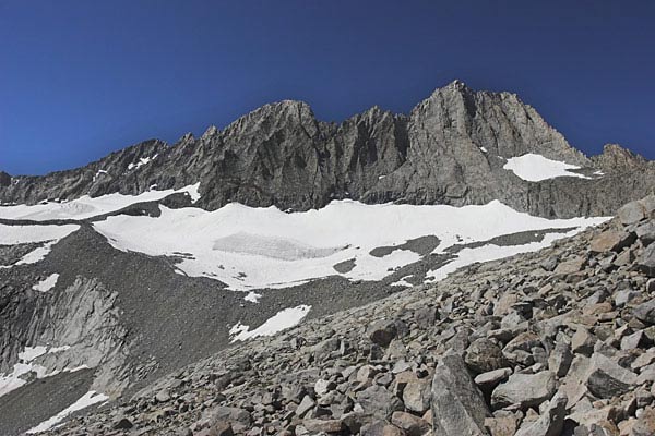
Getting closer. Middile Palisade is on the left, Norman Clyde is on the right. From here we head across the glacier to the morain (the rocky ridge splitting the glacier in half at the base of Middle Pal) and then make our way up the 3rd class rock straight up the face.

The snow was nice and soft crossing the glacier, so we didn't need to use crampons.

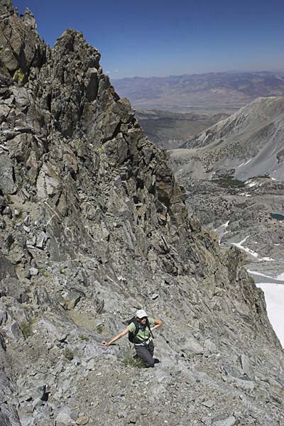
After crossing the glacier, we crossed the morain (seen way down below Brooke) and started climbing the 3rd class rock.

After around 500 ft of climbing or so, the chute we were in opened up to several choices. Our guide book said to cross to the right at this point, so we did. As it turns out that was a mistake. Oh well, it worked...
A short rest, and then up some more...

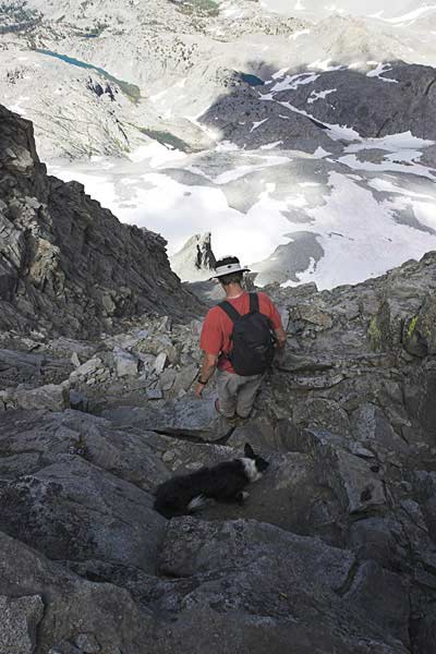
We're pretty high now. And getting close to the top. The only problem was it got steeper and more exposed as we got closer to the top. So, we ended up crossing over a couple chutes to the left where it seemed easier. And after crossing the last one, about 100 ft below the summit, we ran into Mike and his dog, Holly.

Mike and Holly the Wonder Dog on the summit. She climbed all the way up on her own with no help, other than encouragement, from Mike. I was pretty amazed by her ability.
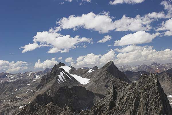
This is the view from the summit to the North West looking along the Palisade Crest towards Mt. Sill, Polemonium, North Palisade, etc...

Brooke and I on the summit.
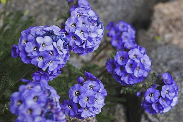
And who would have thought that after seeing nothing but rocks and snow for the last several thousand feet, there would be a patch of purple flowers on the summit?
And again, I was impressed by Holly's ability to make it down this steep face of the mountain. I can't believe she stayed on her feet...